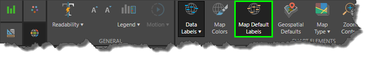
Map Default Labels
The Map Default Labels function is used to show or hide location labels on shape maps. This feature is available only for shape maps (excluding blank maps, which do not feature location labels).
By default, map labels are enabled, but users can disable them for design purposes. Disabling the map labels can create a cleaner, sleeker look that may be desirable for presentations.
How to Hide Default Labels
The Map Default Labels button is located in the Component ribbon. Simply toggle the button on or off as required.
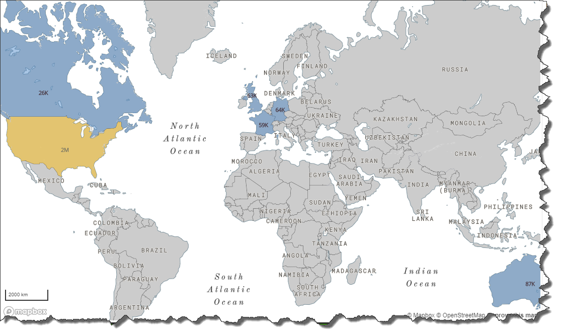
Example
When disabled, all location labels will be hidden, and only data labels will be visible:
